Understanding Watch/Warning/Advisory Definitions
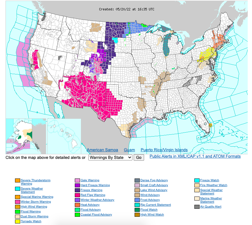
There are countless ways that the National Weather Service tries to keep our communities safe. One of the important ways they do that is by pushing out notifications for various potentially hazardous weather to those that could be impacted. With different climates throughout the country it is important to understand the weather that pertains to where you live. Below you will find all of the listed hazardous weather notifications that come from the National Weather Service. However, it is important to note that these definitions can have different qualifying standards relative to location. The map below is a screenshot of a live National Weather Service map that displays the watches/warnings/advisories for all regions across the United States. Access this NWS map here.
Hazardous Weather Outlook
The Hazardous Weather Outlook will describe potential hazardous weather and hydrologic information of concern in Days 1 through 7. The outlook contains two segments: One segment for the marine zones and adjacent land-based (i.e., coastal) zones and the other segment for the rest of the land-based zones. Each segment of the HWO will contain 3 sections: short term through Day 1, long term for Days 2-7, and spotter information.
Wind Chill Warning: Take Action! NWS issues a wind chill warning when dangerously cold wind chill values are expected or occurring. If you are in an area with a wind chill warning, avoid going outside during the coldest parts of the day. If you do go outside, dress in layers, cover exposed skin, and make sure at least one other person knows your whereabouts. Update them when you arrive safely at your destination.
Wind Chill Watch: Be Prepared: NWS issues a wind chill watch when dangerously cold wind chill values are possible. As with a warning, adjust your plans to avoid being outside during the coldest parts of the day. Make sure your car has at least a half a tank of gas, and update your winter survival kit.
Wind Chill Advisory: Be Aware: NWS issues a wind chill advisory when seasonably cold wind chill values but not extremely cold values are expected or occurring. Be sure you and your loved ones dress appropriately and cover exposed skin when venturing outdoors.
Hard Freeze Warning: Take Action! NWS issues a hard freeze warning when temperatures are expected to drop below 28°F for an extended period of time, killing most types of commercial crops and residential plants.
Freeze Warning: Take Action! When temperatures are forecasted to go below 32°F for a long period of time, NWS issues a freeze warning. This temperature threshold kills some types of commercial crops and residential plants.
Freeze Watch: Be Prepared: NWS issues a freeze watch when there is a potential for significant, widespread freezing temperatures within the next 24-36 hours. A freeze watch is issued in the autumn until the end of the growing season and in the spring at the start of the growing season.
Frost Advisory: Be Aware: A frost advisory means areas of frost are expected or occurring, posing a threat to sensitive vegetation.
Winter Storm Watch
A Winter Storm Watch is issued when there is the potential for significant and hazardous winter weather within 48 hours. It does not mean that significant and hazardous winter weather will occur...it only means it is possible.
Significant and hazardous winter weather is defined as a combination of: 5 inches or more of snow/sleet within a 12-hour period or 7 inches or more of snow/sleet within a 24-hour period AND/OR Enough ice accumulation to cause damage to trees or powerlines AND/OR a life threatening or damaging combination of snow and/or ice accumulation with wind.
Blizzard Warning
A Blizzard Warning means that the following conditions are occurring or expected within the next 12 to 18 hours. Snow and/or blowing snow reducing visibility to 1/4 mile or less for 3 hours or longer AND Sustained winds of 35 mph or greater or frequent gusts to 35 mph or greater.
There is no temperature requirement that must be met to achieve blizzard conditions.
Winter Storm Warning
A Winter Storm Warning is issued when a significant combination of hazardous winter weather is occurring or imminent. Significant and hazardous winter weather is defined as a combination of:
1) 5 inches or more of snow/sleet within a 12-hour period or 7 inches or more of snow/sleet within a 24-hour period AND/OR Enough ice accumulation to cause damage to trees or powerlines. AND/OR a life threatening or damaging combination of snow and/or ice accumulation with wind.
Ice Storm Warning
¼ inch or more of ice accumulation.
Winter Weather Advisory
A Winter Weather Advisory will be issued for any amount of freezing rain, or when 2 to 4 inches of snow (alone or in combination with sleet and freezing rain), is expected to cause a significant inconvenience, but not serious enough to warrant a warning.
Frost Advisory
A Frost Advisory is issued when the minimum temperature is forecast to be 33 to 36 degrees on clear and calm nights during the growing season. A Frost Advisory is issued in the spring at the start of the growing season (when it is late enough to cause damage to new plants and crops).
Dense Fog Advisory
A Dense Fog Advisory is issued when widespread fog is expected to reduce visibilities to 1/4 mile or less over a large area for an extended period of time (2 or more hours).
High Wind Watch
A High Wind Watch is issued when the following conditions are possible: sustained winds of 40 mph or higher for one hour or more OR wind gusts of 58 mph or higher for any duration.
High Wind Warning
A High Wind Warning is issued when sustained winds of 40 mph or higher for one hour or more OR wind gusts of 58 mph or higher for any duration.
Hurricane Watch
A Hurricane Watch is issued when a tropical cyclone containing winds of 64 kt (74 mph) or higher poses a possible threat, generally within 48 hours. These winds may be accompanied by storm surge, coastal flooding, and/or river flooding. The watch does not mean that hurricane conditions will occur. It only means that these conditions are possible.
Hurricane Warning
A Hurricane Warning is issued when sustained winds of 64 kt (74 mph) or higher associated with a tropical cyclone are expected in 36 hours or less. These winds may be accompanied by storm surge, coastal flooding, and/or river flooding. A hurricane warning can remain in effect when dangerously high water or a combination of dangerously high water and exceptionally high waves continue, even though winds may be less than hurricane force.
Wind Advisory
A Wind Advisory is issued when sustained winds of 31 to 39 mph for an hour or more AND/OR wind gusts of 46 to 57 mph for any duration.
Extreme Wind Warning
An Extreme Wind Warning is issued for surface winds of 100 knots (115 MPH) or greater associated with non-convective, downslope, derecho (NOT associated with a tornado), or sustained hurricane winds are expected to occur within one hour.
Small Craft Advisory
An advisory issued by coastal and Great Lakes Weather Forecast Offices (WFO) for areas included in the Coastal Waters Forecast or Nearshore Marine Forecast (NSH) products. Thresholds governing the issuance of small craft advisories are specific to geographic areas. A Small Craft Advisory may also be issued when sea or lake ice exists that could be hazardous to small boats. There is no precise definition of a small craft. Any vessel that may be adversely affected by Small Craft Advisory criteria should be considered a small craft. Other considerations include the experience of the vessel operator, and the type, overall size, and sea worthiness of the vessel.
Gale Warning
A warning of sustained surface winds, or frequent gusts, in the range of 34 knots (39 mph) to 47 knots (54 mph) inclusive, either predicted or occurring, and not directly associated with a tropical cyclone.
Gale Watch
A watch for an increased risk of a gale force wind event for sustained surface winds, or frequent gusts, of 34 knots (39 mph) to 47 knots (54 mph), but its occurrence, location, and/or timing is still uncertain.
Storm Warning
A warning of sustained surface winds, or frequent gusts, in the range of 48 knots (55 mph) to 63 knots (73 mph) inclusive, either predicted or occurring, and not directly associated with a tropical cyclone.
Storm Watch
A watch for an increased risk of a storm force wind event for sustained surface winds, or frequent gusts, of 48 knots (55 mph) to 63 knots (73 mph), but its occurrence, location, and/or timing is still uncertain.
Hurricane Force Wind Warning
A warning for sustained winds, or frequent gusts, of 64 knots (74 mph) or greater, either predicted or occurring, and not directly associated with a tropical cyclone.
Special Marine Warning
(SMW) A warning product issued for potentially hazardous weather conditions usually of short duration (up to 2 hours) producing sustained marine thunderstorm winds or associated gusts of 34 knots or greater; and/or hail 3/4 inch or more in diameter; and/or waterspouts affecting areas included in a Coastal Waters Forecast, a Nearshore Marine Forecast, or an Great Lakes Open Lakes Forecast that is not adequately covered by existing marine warnings. Also used for short duration mesoscale events such as a strong cold front, gravity wave, squall line, etc., lasting less than 2 hours and producing winds or gusts of 34 knots or greater.
Severe Thunderstorm Watch
This is issued by the National Weather Service when conditions are favorable for the development of severe thunderstorms in and close to the watch area. A severe thunderstorm by definition is a thunderstorm that produces one inch hail or larger in diameter and/or winds equal or exceed 58 miles an hour. The size of the watch can vary depending on the weather situation. They are usually issued for a duration of 4 to 8 hours. They are normally issued well in advance of the actual occurrence of severe weather. During the watch, people should review severe thunderstorm safety rules and be prepared to move a place of safety if threatening weather approaches.
Severe Thunderstorm Warning
This is issued when either a severe thunderstorm is indicated by the WSR-88D radar or a spotter reports a thunderstorm producing hail one inch or larger in diameter and/or winds equal or exceed 58 miles an hour; therefore, people in the affected area should seek safe shelter immediately. Severe thunderstorms can produce tornadoes with little or no advance warning. Lightning frequency is not a criteria for issuing a severe thunderstorm warning. They are usually issued for a duration of one hour. They can be issued without a Severe Thunderstorm Watch being already in effect.
Tornado Watch
A Tornado Watch is issued when severe thunderstorms and tornadoes are possible in and near the watch area. It does not mean that they will occur. It only means they are possible. Severe thunderstorms are defined as, winds of 58 mph or higher AND/OR Hail 1 inch in diameter or larger.
Tornado Warning
This is issued when a tornado is indicated by the WSR-88D radar or sighted by spotters; therefore, people in the affected area should seek safe shelter immediately. They can be issued without a Tornado Watch being already in effect. They are usually issued for a duration of around 30 minutes.
Tropical Storm Watch
A Tropical Storm Watch is issued when a tropical cyclone containing winds of 34 to 63 kt (39 to 73 mph) or higher poses a possible threat, generally within 48 hours. These winds may be accompanied by storm surge, coastal flooding, and/or river flooding. The watch does not mean that tropical storm conditions will occur. It only means that these conditions are possible.
Tropical Storm Warning
A Tropical Storm Warning is issued when sustained winds of 34 to 63 kt (39 to 73 mph) or higher associated with a tropical cyclone are expected in 36 hours or less. These winds may be accompanied by storm surge, coastal flooding, and/or river flooding.
Coastal Flood Watch
Flooding with significant impacts is possible. Coastal/Lakeshore Flood Watches are issued using the Coastal/Lakeshore Hazard Message (CFW) product.
Coastal Flood Warning
A Flooding that will pose a serious threat to life and property is occurring, imminent or highly likely. Coastal/Lakeshore Flood Warnings are issued using the Coastal/Lakeshore Hazard Message (CFW) product.
Coastal Flood Advisory
Minor flooding is possible (i.e., over and above normal high tide levels. Coastal/Lakeshore Flood Advisories are issued using the Coastal/Lakeshore Hazard Message (CFW) product.
Flash Flood Watch
A Flash Flood Watch is issued when conditions are favorable for flash flooding. It does not mean that flash flooding will occur, but it is possible.
Flash Flood Warning
A Flash Flood Warning is issued when flash flooding is imminent or occurring.
Flood Watch
A Flood Watch is issued when conditions are favorable for flooding. It does not mean flooding will occur, but it is possible.
Flood Warning
A Flood Warning is issued when flooding is imminent or occurring.
River Flood Watch
A River Flood Watch is issued when river flooding is possible at one or more forecast points along a river.
River Flood Warning
A River Flood Warning is issued when river flooding is occurring or imminent at one or more forecast points along a river.
Excessive Heat Watch
Issued by the National Weather Service when heat indices in excess of 105ºF (41ºC) during the day combined with nighttime low temperatures of 80ºF (27ºC) or higher are forecast to occur for two consecutive days.
Excessive Heat Warning
Issued within 12 hours of the onset of the following criteria: heat index of at least 105°F for more than 3 hours per day for 2 consecutive days, or heat index more than 115°F for any period of time.
Heat Advisory
Issued within 12 hours of the onset of the following conditions: heat index of at least 105°F but less than 115°F for less than 3 hours per day, or nighttime lows above 80°F for 2 consecutive days.
Red Flag Warning
A term used by fire-weather forecasters to call attention to limited weather conditions of particular importance that may result in extreme burning conditions. It is issued when it is an on-going event or the fire weather forecaster has a high degree of confidence that Red Flag criteria will occur within 24 hours of issuance. Red Flag criteria occurs whenever a geographical area has been in a dry spell for a week or two, or for a shorter period , if before spring green-up or after fall color, and the National Fire Danger Rating System (NFDRS) is high to extreme and the following forecast weather parameters are forecasted to be met:
1) a sustained wind average 15 mph or greater
2) relative humidity less than or equal to 25 percent and
3) a temperature of greater than 75 degrees F.
In some states, dry lightning and unstable air are criteria. A Fire Weather Watch may be issued prior to the Red Flag Warning.
Go here to access the National Weather Service glossary, the source of these definitions.